Having studied Mali wildfires study since his Peace Corps service in 2000, Cal State Long Beach professor and chair of the geography department Paul Laris recently earned a $250,000 grant to study gas emissions wildfires.
Laris’ close study began in 2011, when he was first awarded the grant from the National Science Foundation. Laris said this was “seed money” that would be used to test his new hypothesis, which focuses on gathering accurate estimates of gas emissions based on three key variables: burned areas, the type of vegetation burned and moisture levels of burning brush.
This new grant allows him and his research team to go back to Mali and perform controlled burns in 20-square-foot plots of grasslands so that they can test gas emissions of methane, carbon dioxide and carbon monoxide. They intend to set 100 or more fires three times a year, Laris said.
“African savannahs burn far more area and frequently than anywhere else in the world,” Laris said. “And many efforts to estimate emission have a huge uncertainty.”
Laris said that his research proposal was chosen by the NSF, in part, because the research design was very well done.
By being in the field and measuring the emissions with a portable gas analyzer, Laris said he believes his hypothesis will provide more concrete answers.
“We are going to be able to provide very accurate estimates in comparisons to other previous emissions,” Laris said.
According to the project summary submitted to NSF, this study will be one of the first models to track wildfires based on “land use” and “pattern changes,” which will contribute to predicting future fire gas emissions.
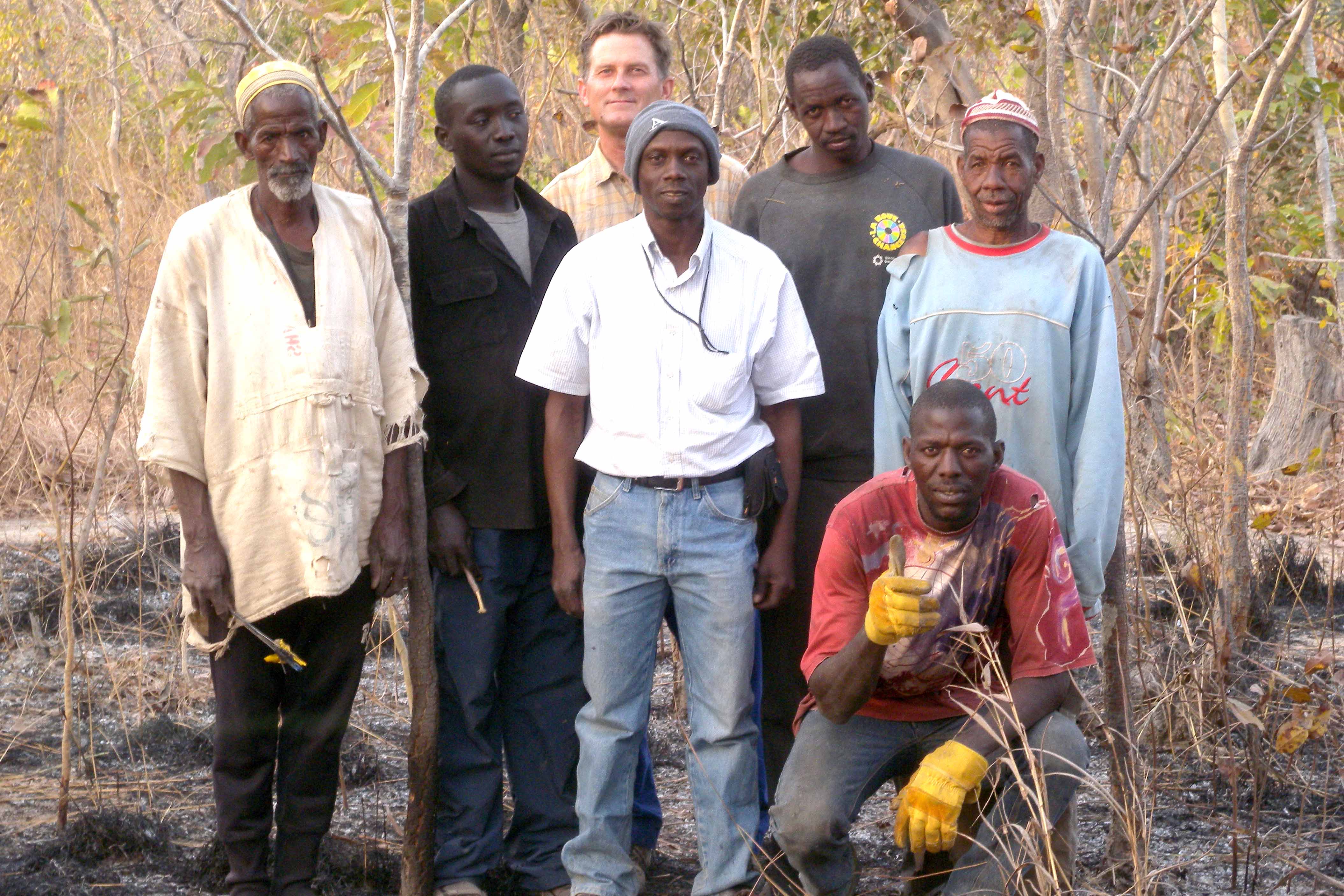
Laris’ field team comprises him, Mali natives and Moussa Kaone from the Ivory Coast, Laris said. His research team includes geography graduate students Sepideh Dadashi and Audrey Jo, and Suzanne Wechsler, a CSULB associate professor of geography and Geographic Information System expert.
Using satellite image analysis software, Erdas Imagine and ENVI (Exelis Visual Information Solutions). Jo said she identifies burned areas in satellite images. She said she is creating a map “that makes it easier to visualize the pattern of fires.”
Jo was selected for the graduate student research assistant position because of her experience and skills learned in an undergraduate research assistant program at CSULB in the summer of 2013.
She said that the results of this research will be presented to Malian decision-makers, “which would hopefully lead to better informed fire management efforts.”
Jo said that although the study takes place in Africa, identifying these fire patterns can predict how and why wildfires burn where they do.
“The results of the research could be applicable close to home,” Jo said.
Laris said he and his research team have been working all summer, analyzing “a wealth of data” collected over that past two years. Laris said he plans to go back to Mali to conduct controlled fires this November. Laris said he is concerned, however, about the spread of the Ebola virus. Should the virus spread to Mali and render us a “no travel zone,” Laris said he will be forced to put a hold on his field experiments.
Laris said that ultimately this research is important in understanding greenhouse gasses and climate change.
He said that Californians don’t have to look far to see the effects, such as the California drought.
“We are addressing a problem that effects everyone,” Laris said. “Global warming impacts the entire world.”